
The article below first appeared in the Croydon Natural History & Scientific Society Bulletin (no.169, September 2020: 58-76). The photographs were taken by Ron Cox. Their copyright and that of the article belong to the Croydon Natural History & Scientific Society (CNHSS). The sources of the maps are indicated in their captions.
The Cherry Road area – talk notes from Ron Cox, transcribed by Tony Skrzypczyk
CNHSS received the transcripts of most of Ron Cox’s talks, some of which were given at our meetings, from his family after he passed, as well as the slides that accompanied them.
These are Ron’s notes for a 60-minute talk which he said were compiled in the 1950s or 1960s (and were clearly updated after 1971 as some prices are quoted in new pence). The photographs are Ron’s own, from slides labelled 1983. Ron did not leave a separate list of his sources but does make some clear in his text. I hope to transcribe further talks if members are interested.
I picked this talk to transcribe first as I moved to Croydon in 1959 aged 2 and a half at 83 Oval Road, attending Oval Road School (Infants and Juniors) where I was in a certain Mrs L. Thornhill’s class and was there when she retired. She was responsible for my interest in the history of Croydon. I moved to Addiscombe Court Road in 1963, then to Tunstall Road in 1980 and finally to Addiscombe Road in 2000. I therefore thoroughly enjoyed transcribing this talk.
I would like to thank Carole Roberts for her considerable assistance in adding the images and for checking my transctiption of Ron’s handwritten notes.
Tony Skrzypczyk
Area for consideration
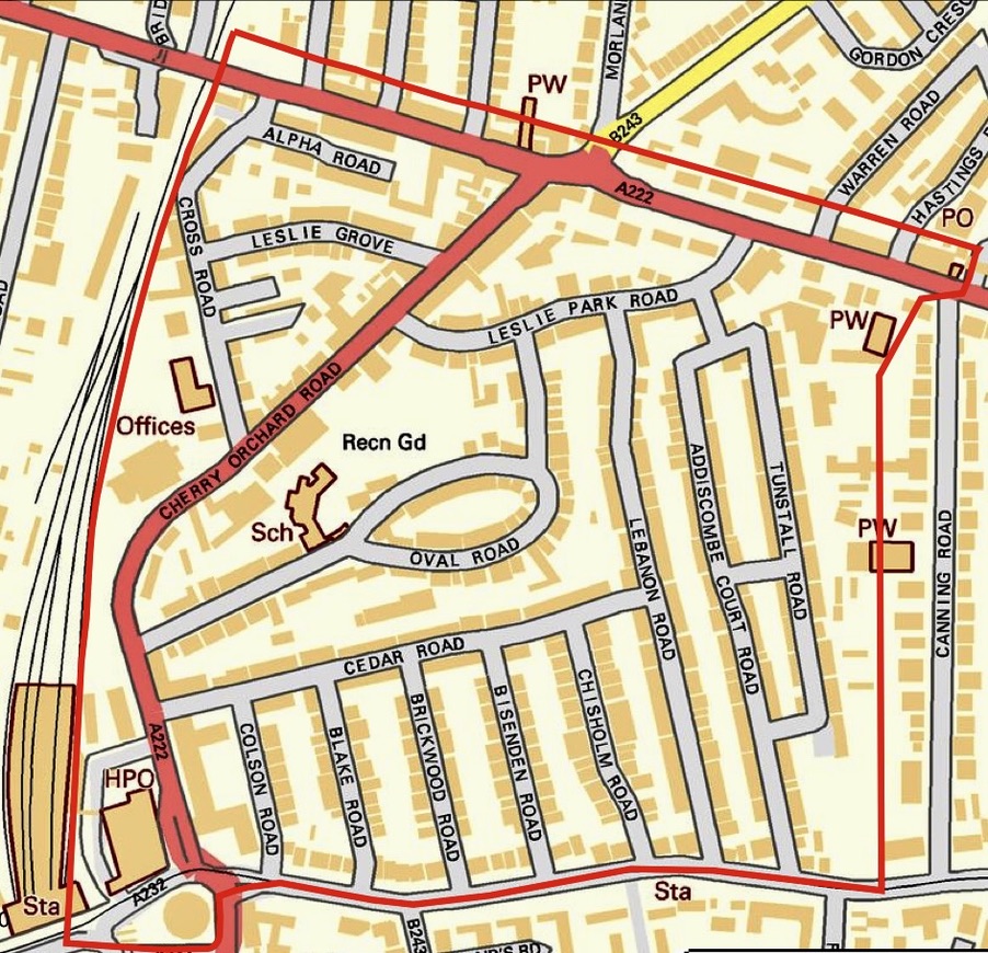
- Cherry Orchard Road, which leads from Addiscombe Road alongside the main Post Office (now closed) by East Croydon Station, northwards to Woodside. As far as The Leslie Arms traffic lights (no longer there), the junction of Lower Addiscombe Road, and Morland Road.
- Also, the roads leading off both sides of Cherry Orchard Road – i.e. the roads on the left, or west or railway side – Cross Road which runs between Cherry Orchard and the railway and it’s little offshoots; and Leslie Grove, which links Cross Road and Cherry Orchard Road, and on the right, or east Oval Road – with its very interesting Oval-shaped centre, and Leslie Park Road, linking Oval Road with Lower Addiscombe Road to the east of the Leslie Arms lights.
- Also, both sides of Lower Addiscombe Road from the Leslie Arms to Windmill Bridge, including Freemasons Road and the south side only of Lower Addiscombe Road from the Leslie Arms to Leslie Park Road.
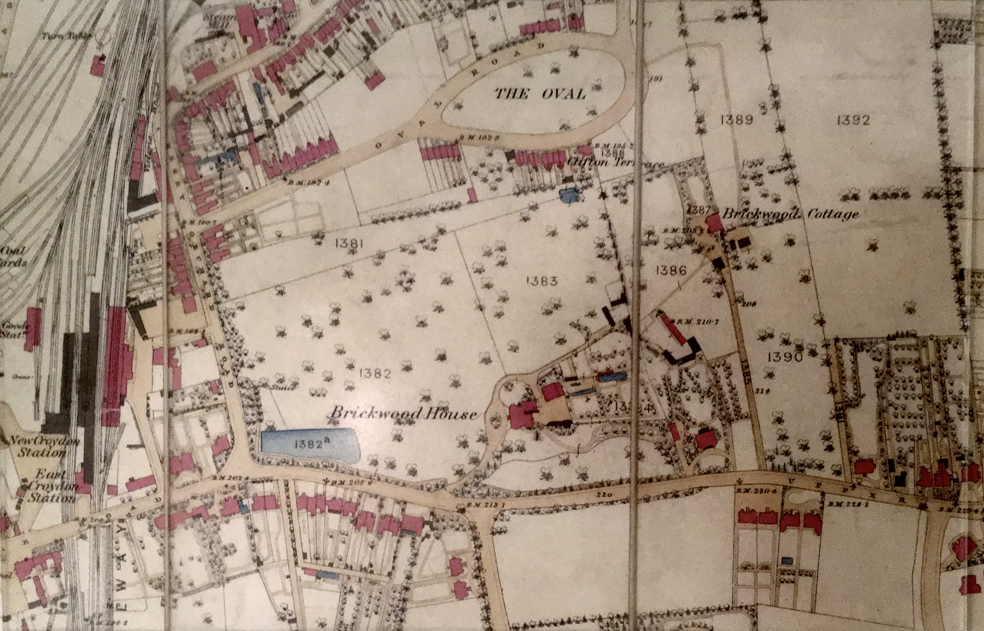
This was virtually all part of Croydon Common until the Croydon Enclosure Act of 1797, as is evidenced by the straightness of the roads in existence before housing development began – e.g. Cherry Orchard Road and Lower Addiscombe Road, then called St James Road. But at once we have a puzzle – the right-angled bend in Cherry Orchard Road – which just ain’t natural. A superficial reaction is that its northern part is on its original alignment, for it goes straight across (more or less) Lower Addiscombe Road towards Woodside and that its southern part has been diverted because of the railway. But the 1800 Enclosure Map shows it following the same line as today – that is 37 years before the railway came and 25 before the first steam line had been projected, so perhaps this is still on the original line. Yet there are arguments against this being the line of the original road in from Woodside and Norwood.
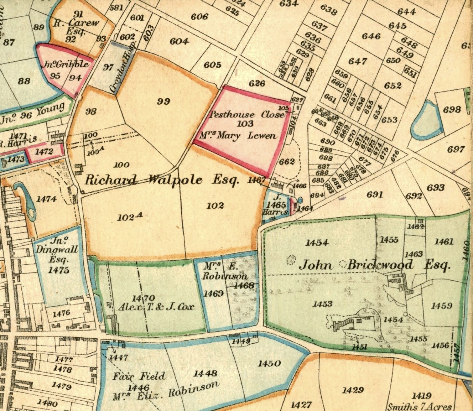
The two arms had different names until about 1840 – suggesting that they are not both parts of the same road – Cherry Orchard Lane – southern arm and Lee’s Road the northern arm probably a corruption of Leaze (a meadow on common land); and coming southwards from Woodside the road terminated at no-where in particular.
We must, therefore, look again for possible diversion – not this time by the railway coming, but, earlier, by the gentleman owner. To the east lay the Brickwood House estate. But any road coming away from the Leslie Arms junction across that estate and later diverted would have led before diversion to only to Park farm and if that had been given access to the common from Park Farm, and if that were diverted, it would have been more direct to divert it to the east of the estate than to the west of it.
A much more likely culprit lay to the west of Chery Orchard lane – this was the Dingwalls estate (just west of East Croydon Station). The Lees Road arm, if continued in a straight line, leads almost exactly to the Park Lane/Wellesley Road/George Street junction and to the Fairfield; and the heart of the town. This is the line one would expect any road from Woodside and Norwood to follow and, in the absence of any other evidence, we must assume that an owner of Dingwalls, near what is now Dingwall Road – must have diverted the road or more precisely, had that portion of it south of the junction with Cherry Orchard Road closed off -forcing all traffic from that direction to the present day – to enter the town centre via Addiscombe Road.
So, by the time of the 1797 Enclosure Act, we had Cherry Orchard Lane leading on to Lee’s Road and across what had been Croydon Common to Woodside and Norwood with the grounds of Brickwood House to the east and that of Dingwalls to the west.
With the coming of the enclosure, the Common land was parcelled out and enclosed. Lower Addiscombe Road (at first called St James’s Road) created or straightened and fenced from an existing track meandering the Common, and Leslie Lodge and Heath Lodge were created as further gentlemen’s estates.
Off Lee’s Road there ran an accommodation road, now Cross Road, leading to gravel pits; and off Cherry Orchard Lane where it bent to become Lee’s Road a track led northwards to the Pest House.
On Lee’s Road itself there were, or there quickly grew up, a few scattered cottages – perhaps relics of earlier squatting; and from Cherry Orchard Lane towards Dingwall Road (i.e. where the GPO Sorting Office and East Croydon Station stand) there was a Cherry Orchard – substantial enough to justify a Cherry Fair on the site when the fruit ripened.
In the late 1830s, this rural scene was shattered when the newly formed London & Brighton Railway Company got Parliamentary approval for a line branching off the then under construction London & Brighton to West Croydon line at what is now Gloucester Road, such a line necessarily avoided the town centre and the pleasure grounds of Brickwood House, and Dingwalls and too the Fairfield and the Archbishop’s Park Hill lands – so it came through the Cherry Orchard.
The town at that time extended only as far as the Wellesley Road/Park Lane/George street site – and, indeed, George Street beyond there was known as Addiscombe Road and Park Lane as Back Lane.
Attempts in July 1829 to sell land on the accommodation rod to the gravel pits – what came to be known as Cross Rd, after James Cross the landlord of The Windmill public house – met with little response ( a Miss Cross head of Oval Seniors Girls school 1873-1879 may have been a later relative ) – the land fronting Cross Road going for as little as 31 new pence per foot frontage; and that on Cherry Orchard Road only 40 new pence.
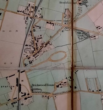
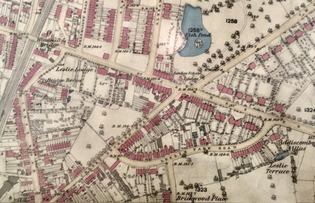
The first substantial land sale took place in the area in 1851 and in considering what happened over the next 50 years it is best if we look, in order, at Cherry Orchard Road towards but not as far as, the Leslie Arms traffic lights – together with Cross Road; then the break up of the Leslie Lodge Estate in this order. First the portion south of Lower Addiscombe Road and east of Cherry Orchard Road: then that south of Lower Addiscombe Road and between Cherry Orchard Road and Cross Road (the portion where the house itself stood); and then that part north of Lower Addiscombe Road, Freemasons Road and Morland Road; and then Oval Road; and, lastly, with the break-up of the Brickwood Estate, the Cherry Orchard Road frontage of that estate near East Croydon Station.
Cherry Orchard Road and Cross Road
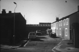
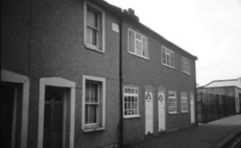
Beginning as a narrow accommodation road to gravel pits and with dirty steam locomotives running within a few yards of much of its length Cross Road never had a chance. It already had many cottages by 1851, almost all occupied by working-class people.
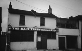
We need only note the North Pole beer house (now a printers), several people employed by the HEIC (Honourable East India Company) College at Addiscombe (e.g. the Head Gardener, and the Bandmaster) and at no 26 a rope maker named William Trumble, whose wife took in laundry, who was almost certainly grandfather of James Trumble who was Mayor from 1910-1912.
Also, Mr James Hall, the Corn and Coal Merchant, whose father George Valentine Hall (1786-1845) had founded the firm, had a private house towards the south end of Lees’ Road more or less facing across to his depot alongside the railway.
Shortly after the 1851 census, the Railway Company put onto the market, land surplus to its needs which it had bought in 1841. This comprised land at the south end of Cherry Orchard Road – on both sides of the still existing slip road to the station – a road that at that time led straight to a booking office: and extending around the corner of the road that leads down between the Station and the present Post Office.
We are reminded at how up-market Addiscombe Road was by the fact that the land was intended for semi-detached villas, there was a minimum stipulated size (or at least cost) of house and “F.D.Banister, the surveyor … to the Railway Company, has prepared plans and specifications of houses suitable to the situation… which will be exhibited at the sale. Purchasers are not compelled to adopt these but can purchase copies”.
Further purchasers were offered “the privilege of making back communications from their gardens to the entrance road to the station”.
These well-to-do would-be commuters were advised “The situation of the land overlooking Brickwood Park renders it very improbable that the present picturesque view will ever be interfered with”.
Houses were erected soon after the sale, but not before the four plots immediately south of the slip road had been more than halved in-depth to make at the bottom of their garden’s way for The Railway Hotel – now the Sorter & Porter P.H. behind.
By the 1890s some of the houses had become commercial premises or schools or clubs; and in the 1920’s they were mainly taken over by Creeds the engineers, who had occupied the site opposite, thus interfering with the promise of an eternal picturesque view.
The Leslie Lodge Estate-South of Lower Addiscombe Road & East of Cherry Orchard Road
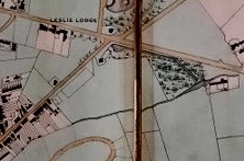
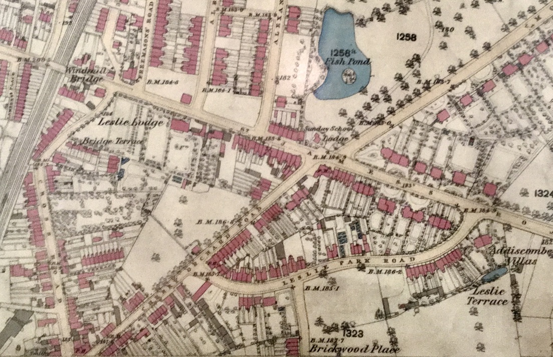
The northern edge of Cherry Orchard Road and the south side of Lower Addiscombe Road on both sides of the junction, and to the north side of Lower Addiscombe Road west of the junction was a private estate, the Leslie Lodge Estate.
In March 1851, its owner Mary Vandervell, a widow put part of it onto the market – i.e. the part east of Cherry Orchard Road and south of Lower Addiscombe Road. The sale particulars referred to the accelerated train service and decreased annuals fares to London and to the fact that a new road Leslie Park Road had been made through the land giving a total frontage of 3000 feet (900 metres) “of a most interesting and picturesque character” and constituting a “first-class site for the erection of suburban residences”.
This was the first break up of a gentleman’s estate in the area and, indeed one of the earliest in Croydon, so it is important to see what happened:
- All the lots were sold which, as we have seen elsewhere was by no means the case – and the gross receipts were £2780.
- Sixteen or possibly 19 of the 27 lots went to Croydon purchasers, including Samuel Freeman of Croydon Common, who bought 3 for £470;
- John Morley, a woodworker and charcoal-burner of Broad Green who later was advertising as “Contractor to the Royal Palaces” – he bought 2 lots from £313;
- G.H.Holledge, a George Street timber merchant, who made several unsuccessful attempts to get on the Local Board of Health, bought 3 lots for £304;
- And John Hempstead, a Norwood farmer who also stood for the Local Board of Health in 1862, but got a derisory number of votes.
- 8 lots were bought by Londoners, including 2 by William Vaughan, a builder.
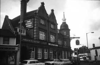
Within a decade the entire Lower Addiscombe Road frontage had been developed, with going west to east, the Leslie Arms Beershop (P.H.), 5 cottages which were converted into shops about 1895. And some inferior houses erected by William Vaughan, including one called Kirby Bedon which was occupied for a dozen or more years around the 1880s by Edward Berrey FRSC and a member of CNHSS, who was possibly the father or uncle of Sir Henry Berrey, an OW (Old Whitgiftian) who later became architect and surveyor for the Foundation.
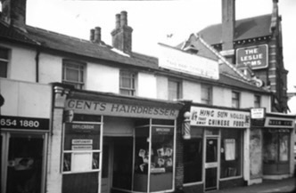
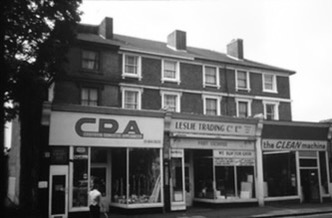
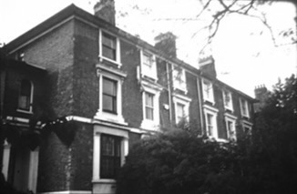
That house on a 50ft frontage had a carriage approach, was heated by hot water pipes, had drawing and dining rooms each 19ft by 14ft with statutory marble chimney pieces, a library, three bedrooms on the 1st and 2nd floors, various servants apartments, a pigeon house and a tricycle shed when offered for sale in 1890; it was withdrawn at £1000. A block of flats Kirby House is now on the site.
Development on the Cherry Orchard frontage came much more slowly. The north side of Leslie Park Road, i.e that side backing onto Cherry Orchard Road and Lower Addiscombe Road was almost entirely built over within a decade of the sale, but the other side, especially between the future Lebanon Road and Oval Road, remained as meadows until about 1890. But certainly, from Mrs Vandervell’s point of view, the sale had been a success and this may well have prompted her to continue the process.
The Leslie Lodge Estate – south of Lower Addiscombe Road and west of Cherry Orchard Road
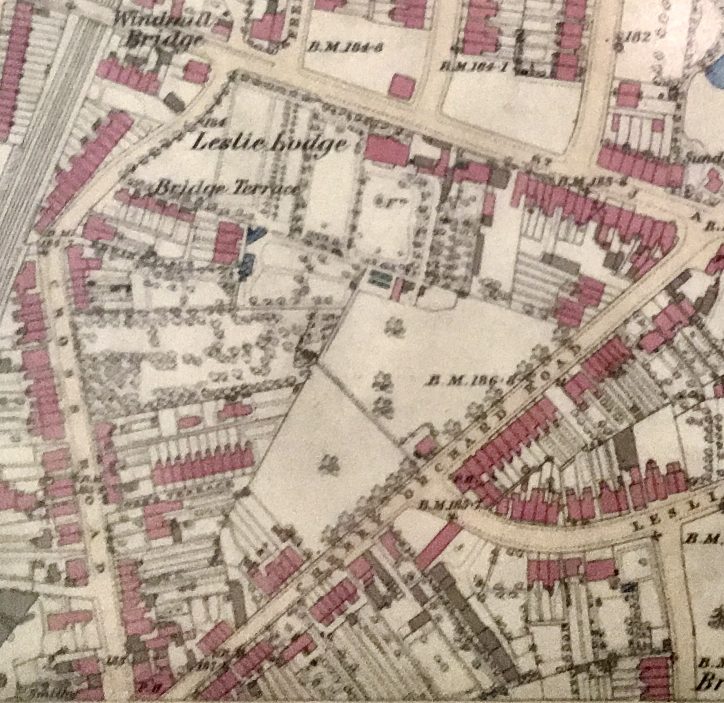
So only 5 months later in August 1851 she put much of the remainder of the estate on the market, including the house itself. This comprised of 619 feet of frontage (190m) on St James Road (now Lower Addiscombe Road), 686feet (210m) on Cherry Orchard Road and 388feet (119m) though not continuous on Cross Road.
Lot 2, on the Lower Addiscombe Road/Cherry Orchard Road comprised a new detached house and a paddock: and within a decade a further ten or eleven houses fronting Lower Addiscombe Road, shortly to be converted to shops.
Lot 3, another detached house called Thornborough, dating perhaps from 1821 was sold, with its stabling and coach house to John Morland, an Anglican who later turned Quaker, who lived nearly opposite on the Heath Lodge estate, who was about this time a member of the Local Board of Health. It continued to be privately occupied by distinguished sounding tenants until the end of the century when a builder and timber merchant found a use for the premises and the attached land. The house has now gone.
Lot 4, on the corner of Cross Road and St James Road then St James Road (now Lower Addiscombe Road) was bought but remained undeveloped.
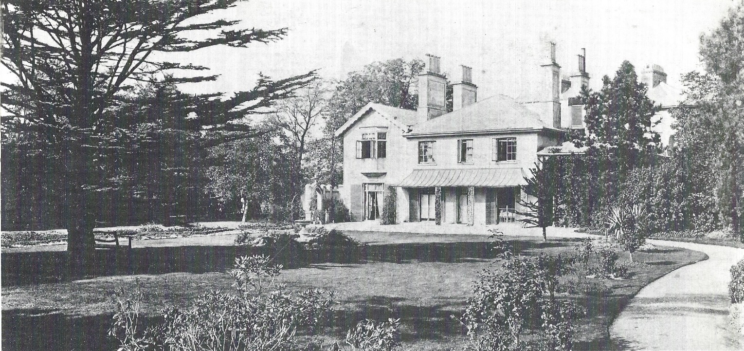
The other lot was Lot 1, the house itself close to the road with its ornamental grounds and paddocks and with a meadow occupying an important site for building purposes. The house itself was described as a Villa Residence “a delightful retreat for a modest-sized family”. It had, on the 1st floor 5 bedrooms, 4 servants apartments and 2 water closets. On the ground floor a double drawing room 34 feet long (10m) with marble chimneypieces and French casements opening onto the gardens. There were, too, the usual stables, coach house etc, and an ornamental fountain, parterres, choice shrubs, 2 greenhouses heated by hot water pipes and a lodge fronting Cherry Orchard Road.
There were no takers but then, 9 years later, in 1860 it was bought by Mr Michael Saward a retired or about to retire actuary, a promoter of the revived Whitgift Schools and President of the Croydon Liberal association; and when he died in 1874, the estate came back onto the market.
The house was substantially unchanged during his occupation, except one of the servant’s bedrooms had become a boudoir. The house now had “conveniences for poultry”. The land at the rear was offered, in the 1874 sale, as a separate lot “available for building purposes”. It was pointed out that a considerable increase in frontage could be obtained by the construction of a new road connecting Cherry Orchard Road and Cross Road “by which means a Profitable Building Scheme could be carried out without interfering with the privacy of the principal house and grounds”. Whoever bought this land put in the road – Leslie Grove – and then six months later attempted to re-sell some of the land but divided up into separate building plots. In the new Leslie Grove there were 19 lots, mainly on a 20feet (6m) frontage – all but one of them on the south side of the road. They were all sold except the 4 nearest Cross Road and an odd-shaped piece of land on the other side of the new road.
A further 6 lots all fronting Cross Road, failed to find a buyer although they were soon afterwards built over, and 8 of 17 lots fronting Cherry Orchard Road were unsold. It would seem then, that Cross Road was not seen as a good investment. Cherry Orchard Road was not favoured – perhaps because it was not one thing or the other – neither good for houses nor shops but there was a demand for land for houses on undeveloped ground.
There were restrictive covenants – every house in Leslie Grove and this part of Leslie Grove to cost no less than £120 and in this part of Cherry Orchard Road £200, with no manufacturing; and no innkeeper, victualler or beer retailer without the written consent of the vendor. Shops were permissible in Cherry Orchard Road and Cross Roads but not Leslie Grove where also nothing but fences could be erected within five feet of the road.
The Vendor – presumably the Executor for Saward’s estate- did not lack persistence. 10 weeks after the April 1875 sale he offered the unsold 20 lots again. Not one was sold. 16 weeks later he did so again. Only 4 – all in Cherry Orchard Road were sold. Seven months later the remaining 16 were again on offer. I do not know the result. The lots in Leslie Grove were not all developed for almost 25 years.
The corner of the Leslie Lodge Estate that was most difficult to shift was that at the junction of Cross Road and Lower Addiscombe Road, right by Windmill Bridge. Mrs Vandervell had leased it from Elys Davy’s Almshouses and the 21-year lease had only 6 years to run when first put on the market. Eventually, in 1896, it was put up for sale separately by a desperate agent who described it vaguely as being for “shops, small villas or trade premises” and then for the want of something better, continued: “Many improvements have within the last few years taken place in this locality, including the widening of Windmill Bridge to 40 feet which has had the object of greatly enhancing the value of the land in question, giving it a good approach and aspect”.
The outcome was the enigmatically-named Alpha Road – a straight cul-de-sac with ten houses on the north side and two pairs of four tucked in behind an already existing Mission Hall on the south side, together with a further two facing Cross Road. The valuable Lower Addiscombe Road frontage was lost and if it were not for the hoardings one would see straight into the back gardens of some of the Alpha Road houses.
The Leslie Lodge Estate – north of Lower Addiscombe Road
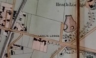
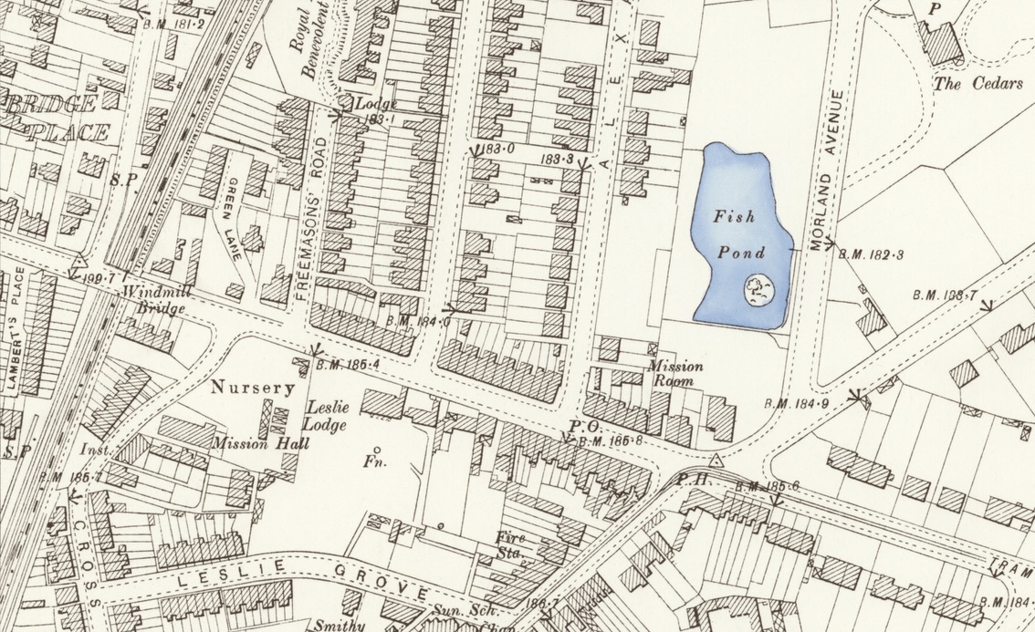
During Michael Saward’s time at Leslie Lodge – in the 1860s – that part of his estate lying on the north side of Lower Addiscombe Road began to be developed. Two new roads – Alexandra Road and Albert Road (shortly renamed Davidson Road) – had been laid down and four shops had been built on the Lower Addiscombe Road frontage, immediately west of Davidson Road. Also, very soon, a further six shops were erected on the same frontage between Alexandra Road and the Heath Lodge School from which – together with a Lodge to Heath Lodge – marked the start of the Heath Lodge frontage just before Morland Road was reached. Several of these shops – especially a wine merchant’s, a draper’s, a butcher’s, and a fishmonger’s – were to have uninterrupted continuity of use for very many years; a sure sign of a successful shopping parade.
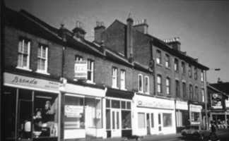
In 1871 more of this frontage was offered for sale and “in order to preserve the respectability of the neighbourhood the purchasers will be restricted as to the value of shops and houses” that may be erected. There were to be no dealers in wines, spirits or malt liqueurs – perhaps in deference to the wine merchant already there.
But, in spite of the apparent success of the shops already trading, of the six lots offered for sale in 1871, only one was bid for – and withdrawn at £60; and no others earned a bid at all.
There was a little more success, however, seven years later when – between Davidson and Alexandra Roads – a further sale quickly resulted in the erection of a further thirteen shops.
Oval Road
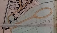
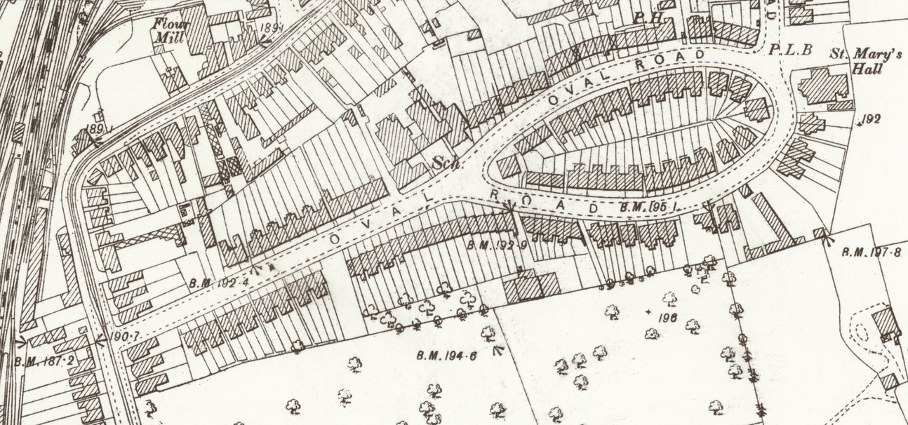
Quite early in, in September 1852, an outlying part of the Brickwood House Estate came onto the market. The sale has a number of interesting features:
- A 40 feet (12m) road had been projected though not necessarily, even at this stage constructed, leaving Cherry Orchard Road and then opening out to form an Oval. The significance of this Oval we shall discover later.
- With the creation of Leslie Park Road, it was now possible to link the Oval to with Leslie Park Road, and this was done.
- We see from this how a decision to sell one estate – probably caused by a death – could affect future houses’ layout not only there but also on adjoining lands.
- The Oval Road land was offered – in this 1852 sale – in 34 lots on frontages ranging from 40 feet (12m) to 50 feet (15m) – i.e.wide enough for a pair or a group of three cottages.
- However, of the 34 lots, only 13 were sold, scattered about – but the average cost per foot of frontage was £1.42 compared with 31 pence and 40 pence in Cross Road and Cherry Orchard Road respectively, before the railway had arrived.
- The other 21 lots were all bid for but the reserve price was not reached.
Among the purchasers were:
- Samuel Freeman of Croydon Common, who had bought 3 lots in Leslie Park Road and Cherry Orchard Road a year earlier, and now bought a further three;
- James Hall, the Corn and Coal Merchant, who bought 5 lots in strategic positions and bid strongly for them his average, on standard shaped lots being nearly £2 per foot against an average of £1.42;
- John Morley, the Broad Green Wood Broker by Royal Appointment, who added two lots to the lots he had purchased the previous year in Leslie Park Road – a useful stub of land in the best tradition of monopoly.
- No Londoners or even other non-Croydonians made any further purchases except that one of James Hall’s plots seems to have gone initially, for less money, to a man from Bermondsey who immediately re-sold it.
No land was offered for sale within the Oval for reasons that will become apparent shortly.
In the 1852 sale just described one particular portion of land that was conspicuous as not being on offer was a 309 feet (90m) frontage on the north side, facing the western end of the Oval itself.
This was because it was not owned by the Brickwood Estate but by The Trustees of the Waste Land on behalf of the Parish. But in September 1855, this was offered as six lots on frontages of between 50 feet(15m) and 55 feet (17m). One lot was not bought at the time but within two or three years 4 cottages (Claremont Terrace nos 87-93) were being built with basements because, almost certainly, on old gravel workings – and as 93 was first occupied by George Louch Harding, a builder, who at the time of the 1851 Census – 4 years earlier – had been a Carpenter of 28 living in Cross Road – and as the garden of 93 extended across the back end of the other three cottages we may assume he had built them and stole part of the then would-be gardens as his.
Two other plots were bought on behalf of Henry Rixon, a clerk to a Corn Merchant, who already had the land immediately behind – fronting Cherry Orchard Road – on which there was a house with stabling and a cottage; and the other three lots were purchased by our old mate John Morley the Royal Wood Broker; who already had the adjoining Jasmine Terrace 1-8 (107-121) who almost immediately built on the newly-acquired lots but the terrace was not completed (9 to 12: 123-129) for another 15 years or so – perhaps he was under capitalised.
The five lots that were sold fetched only 69 new pence per foot frontage – much nearer the pre-railway Cherry Orchard/Cross Roads prices of 40 pence and 31 pence than the price of the adjoining land only 3 years earlier which had gone for £1.42. Why the difference? Had there been euphoria about the large 1852 sale of a virgin estate? Did the Auctioneer make much less effort on behalf of the Parish than he had for a private Vendor? Was there even a ‘fiddle’? Or was it known that the Parish would sell at any old price – not withdraw it if a certain price was not realised?
The other interesting thing is a note in the Sale Particulars about the Oval itself: The conveyance gives a perpetual right of way over Oval Road “and also alike right to use “The Oval” as a pleasure ground (on which no building is to be erected, except for horticultural purposes, and not higher than twenty feet) subject to the payment of a proportion of the expenses of… enclosing, maintaining and cultivating ‘The Oval’ as a garden or pleasure ground for the general recreation of the parties entitled to the use thereof”.
An unusual idea. What then went wrong? We see, if we examine particulars of a sale only 16 years later, in 1871 what happened:
“By the 26th December 1851 indenture the Oval piece of land was… subject to several grants said to have been made by Solomon Jacob Waley (perhaps the lessee of Brickwood House) for use as a pleasure ground. But by Indenture of 28th June 1869 John Hempstead.. Charles Hall, Henry Rixon and others recorded that none others but they had the rights; they had all joined in releasing and extinguishing their rights over the Oval thereby extinguishing those rights.”
Whether they did this for payment or personal gain or because such an idealistic scheme had proved unworkable we shall never know.
Anyway, at this 1871 sale Charles Hall, of Brickwood Villa, bought a sizable chunk of the Oval for £305. He also bought, in the same sale, the land on which Oval School now stands, at the very high price of £1.90 per foot frontage.
Ironically that land was close to the lots which the Waste Land Trustees had sold only 16 years earlier – though they could not have expected to foresee the creation of the School Board.
The release of the Oval for building did not mean that it was immediately developed – indeed it was probably a decade before any of it was built on. A typical development eventually resulted from a sale of eight lots in November 1881. They constituted roughly the middle portion of the Oval. They were bought on building leases by Mr R J Godson (or 7 of the 8 were, anyway), he undertaking to erect by 29th September 1882 (i.e.within 10 ½ months) houses costing at least £200 each, with or without stables and to the satisfaction of the lessor. Godson was a builders merchant in George St and lived at Lynton Lodge, Dingwall Road. He was a member of the Council for about 10 years from 1886. He went bankrupt in 1911.
Marriage’s Houses
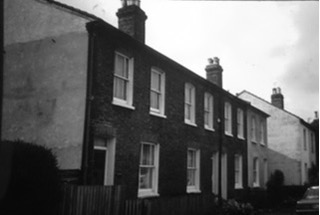
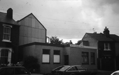
The builder was William Marriage who had moved, earlier, from 164 Oval Road (No 4 Clifden Terrace) to 166 Clifden Villa where he remained until at least 1907.
For 20 years or more, he had a timber yard between 170-172 Oval Road – all these Marriage properties are at the Leslie Park Road end of Oval Road. And he must have been a substantial builder in the vicinity.
For a time there was a Miss Marriage on the staff at one of the Oval Road Schools.
The land adjoining the Godson/Marriage land in the Oval – and indeed the whole eastern portion of the Oval was built by a man with even stronger local connections. In February 1884 Henry Streeter rented the land at £42 p.a.and contracted to build 10 houses. These were Northcote Villas 1 and 2; Salisbury Villas 1 and 2; Kenilworth Villas 1 and 2; Brambridge Villas 1 and 2; and Twyford Villas 1 and 2 (nos 22-31).
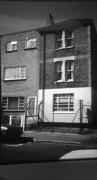
He also contracted in 1887, to build houses at 101-111 Cherry Orchard Road on grazing land occupied by a Cross Road butcher. Earlier, Henry, or his father, also Henry Streeter, had lived at 114 Cherry Orchard Road, a cottage immediately north of the Cherry Orchard beer house. In the 1860s he had taken over that establishment combining beer selling with being a carman. He then seems to have moved to 62 Leslie Park Road where he continued his cartage business and Ward’s Directory records on 3rd December 1872 a “fatal accident to a carter named Streeter at Leslie Park Road”. At the start of the 20th century, Streeter Brothers had a yard at 59 Leslie Park Road – which is almost next door as the properties are numbered consecutively; and E Streeter, Contractor and Asphalte Manufacturer, remained in residence at no 62 at least until WWI.
My current phone book shows an entry H Streeter (Contractors) Ltd, Building Contractors, back at 114 Cherry Orchard Road where they had lived before taking over the Cherry Orchard beer house.
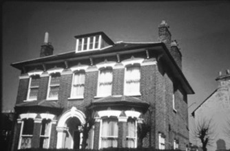
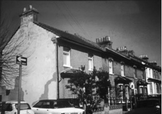
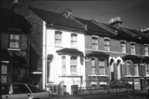
Reverting to the November 1881 Building Leases to Godson and Marriage, I note, that a part of the north-facing half of the Oval that had been bought by Charles Hall is shown on the 1881 plan as being in the hands of a Mr Horrocks. He was the first occupant of Wilton House (no1), the house facing you as approach the Oval from Cherry Orchard Road. He had earlier lived in Cherry Orchard Road, then at 128 Oval Road when he had a timber yard next door. I think he probably built nos 2 to 13 (north-facing ) and 40 to 50 (south-facing) i.e. the houses both sides of Wilton House, in which case the entire Oval is attributable to three builders: John Horrocks – decorative; William Marriage – grim; Henry Streeter – flowing. (Incidentally a Miss Marriage a dressmaker lived at no 50 – next door to Wilton House.)
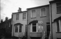
The Cherry Orchard Road (east) frontage near East Croydon Station
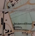
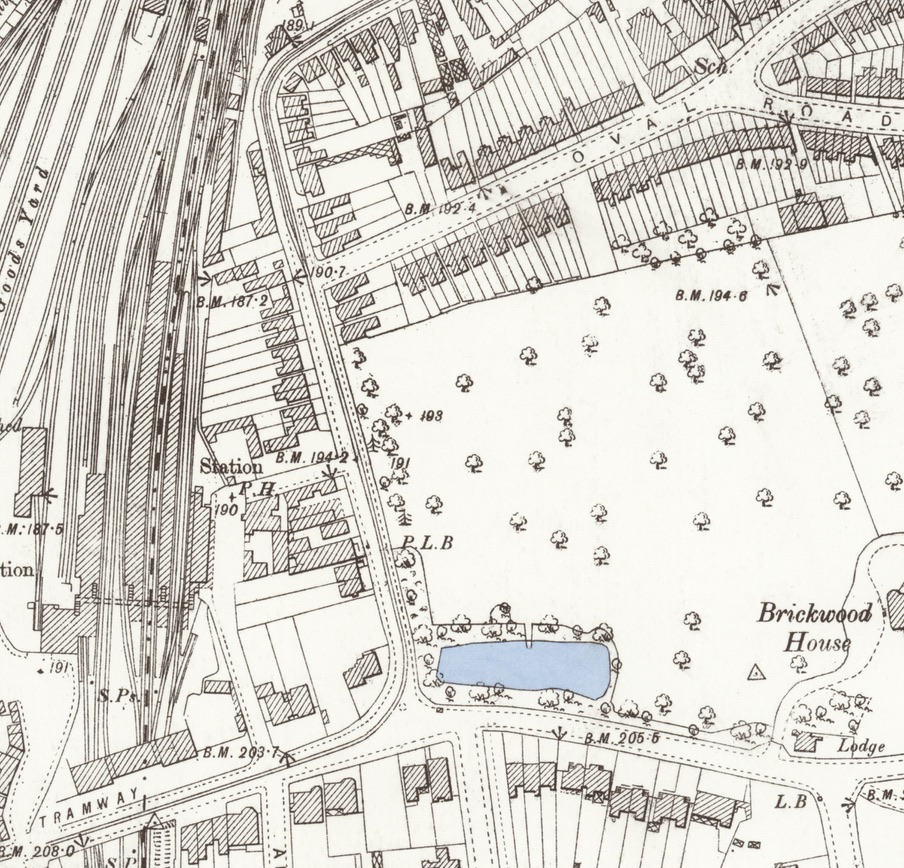
In 1907 the entire Brickwood House estate, of 16 acres, was offered for building purposes. The sale particulars referred not only to the excellent train service, naming Liverpool Street and Willesden Junction, as well as the most obvious stations but also to the estate being only two minutes to the main shops, abutting onto an electric tram route, and being close to Whitgift Grammar and the Girls’ High Schools.
The land was sold free of any restrictions, permitting “shops, businesses or factory premises or superior residences or small villas”.
None of the Cherry Orchard Road land was bought up, and it was again offered in October 1908. There was space left on the frontage for a proposed new road – Cedar Road. Again it all went unsold and then, about 1910, an American Rolling Skating Rink was built on the land between Addiscombe Road and Cedar Road – just where the Agents – some 56 years earlier – had said it “very improbable that the picturesque view ever be interfered with”. About 1915 it became Creed’s, the telegraph engineers.
Reprise.
Finally since WWII new commercial buildings have been erected on the site of Creed’s; and across the road where some of the up-market buildings had been built backing onto the station, the Cherry Orchard Road/Addiscombe Road corner, where part of the Cherry Orchard was, has become a huge GPO Sorting Office.
Otherwise, Cherry Orchard Road displays most of the symptoms of 1980s dereliction; few people live in it, it has unprofitable, down-at-heel shop premises – few of which are in the retail business; it has unoccupied, empty and derelict sites, and from time to time massage parlours; and is battered by heavy traffic.
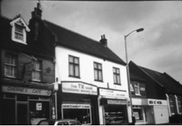
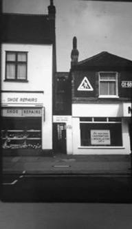
Cross Road remains in a slumber – it is too narrow and tortuous to be a rat run for goods vehicles and part of it is now one way.
Leslie Grove remains almost unchanged from the day it was built and: Leslie Park Road and Oval Road provide a combination of seediness and property improvement – somewhat at risk but much less than if the properties had been larger, like the long disappeared ones at the south end of Cherry Orchard Road.
The Oval itself – that attempt to provide a private pleasure ground for inhabitants of Oval Road – remains only as a shape and as a name.
FIN

